Bypassed Reach: about 9 miles Flow near Tapoco: about 130 cfs Diverted flow: about 900 cfs Total drop: 640 feet (last 2 miles drop at 100 feet per mile) Guidebook: Carolina Whitewater: A Paddler's Guide to the Western Carolinas, by Bob and David Benner, Menasha Ridge Press, 1993, p. 45.
Gauges:
Whitewater Study
Interview with Cheoah Paddlers
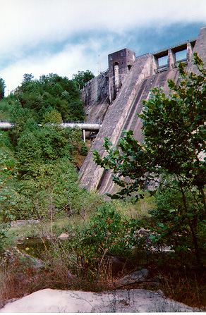
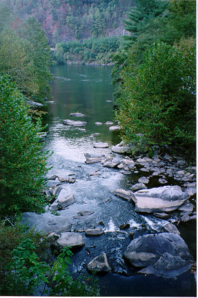
More Photos:
Cheoah River 1
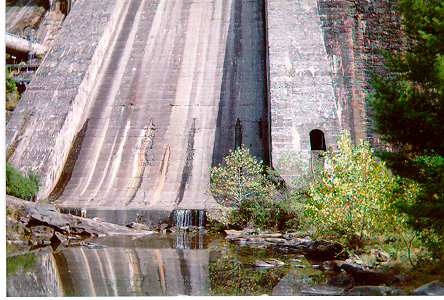
| Photo by Kirk Otey, September 1999 near Tapoco Lodge |
This is the pipe that bypasses about 9 miles of the Cheoah River, shown here where it crosses Hwy. 129. When generating, it carries about 900 cfs from Santeetlah Lake five miles to Santeetlah Powerhouse, located on Cheoah Lake. Photo by Philip Young, October 1999 | |
Cheoah River emerging from the undergrowth. Lack of water has allowed trees and brush to take over the streambed in many places. Photo by Philip Young, October 1999 |
Santeetlah Dam on the Cheoah River. The beginning of the five-mile pipe (which bypasses nine miles of streambed) can be seen here. Photo by Kirk Otey, September 1999 |
Confluence of the Cheoah River (foreground) and the Little Tennessee (Calderwood Lake).Photo by Philip Young, October 1999 |
The only flow in the Cheoah River immediately below Santeetlah Dam comes from this 2 cfs leak in the dam. Tributaries such as Yellow Creek contribute more but are miles downstream. Photo by Kirk Otey, September 1999 |
Send feedback to [email protected].