


Calderwood Dam is located on the Little Tennessee River in east Tennessee. The river serves as the boundary between Blount and Monroe counties. Water from the dam is piped through a mountain to the powerhouse one mile downstream. This leaves a one mile U-shaped bend in the river that is bypassed, or dewatered. The test release shown below of 1300 cfs was judged to be too high for a safe and attractive fishery. Photos by Kirk Otey, October 18, 2000 unless otherwise noted.
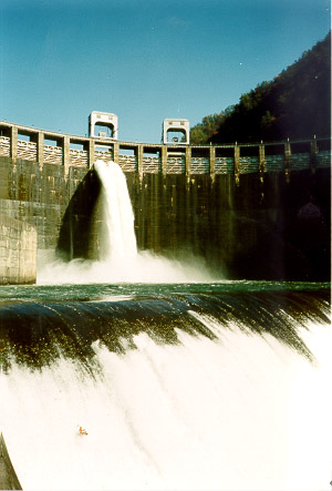
Calderwood Dam release for fishery studies. |
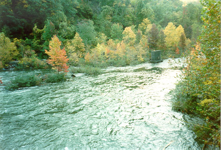
Bypass below Calderwood Dam. |
|
Normandeau Associates take a transect. |
|
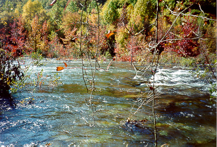
A riffle on the bypass section. |
|
|
Calderwood Dam from the overlook on Hwy. 129.Photo by Philip Young, October 1999 |
|
|
Project powerlines from Calderwood overlook on Hwy. 129, facing north. Photo by Philip Young, October 1999 |
Cheoah River Page | Cheoah Dam | Chilhowee Dam
TCWN Home
Send feedback to [email protected].